Why Land Surveyors Are More Important Than You Think
Why Land Surveyors Are More Important Than You Think
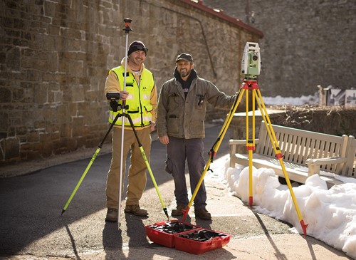
While it is the second-oldest profession in the world, some people don’t know what land surveying is. Land surveying is the art of mapping and measuring a designated area. Land surveyors are constantly in the field testing land for projects. They also determine land boundaries in their calculations. Land surveyors then convey this information to designers, architects, and engineers to design a project.
The first sign of land surveying dates back to 2700 BC in ancient Egypt. Land surveying played a huge role in the design of the Great Pyramids of Giza. Evidence shows that the Egyptians used basic geometry to set boundary lines for the placement of the Pyramids. Documentation shows that these boundaries were used for a legal document called the Egyptian Land Register.
Land surveyors use a wide variety of accurate technology to gather information about land. An important piece of equipment used by land surveyors is a theodolite. Theodolites can measure angles in both the horizontal and vertical planes. Essentially, a theodolite is a mini telescope that is used for land surveying measurements. The theodolite is an accurate tool that is vital to the land surveying industry.
Today, the most widely used surveying software is a GPS system. With this, surveyors can scan a large area of land in a short period of time. The GPS takes accurate measurements in a single survey even when weather conditions are not ideal.
When should you have your land surveyed? You may be required to have your land surveyed sometime soon. Here are the main reasons for land surveys:
- Building on a Property – Some municipalities have legal limits that require a new addition to a home to be so many feet away from the property line.
- Selling and Buying Land – Boundaries should be confirmed before any land purchases are made.
- Boundary Disputes – To avoid legal issues and lawsuits, homeowners should have a land survey available.
- Fences and Walls – Fences that run along a property line sometimes need to have a land survey completed before building.
A land surveyor’s measurements are important for every construction project. Together, land surveyors, engineers, and architects analyze survey data to create an optimal design for a project.
CEDARVILLE uses conventional and aerial mapping for surveying. Call 610-705-4500 or email info@cedarvilleeng.com to find out how we can help with your project.
By: J. Auerbach
What can we do for you?
Address: CEDARVILLE Engineering Group, LLC 159 E. High Street, Suite 500 Pottstown, PA 19464 Phone: 610-705-4500 Fax: 610-705-4900 info@cedarvilleeng.com