Land Surveyors Benefit from GPS Services
Land Surveyors Benefit from GPS Services

Smartphones give us everything at our fingertips. The internet provides valuable information and entertaining content. The camera captures memories that last a lifetime. Most importantly, the maps keep us from getting lost. Every map application uses the Global Positioning System (GPS) to enhance road safety and efficient travel routes.
GPS is used everywhere. Whether it be for navigation or research, GPS is available to track proximity and locality. GPS is a system of 31 operational satellites owned and operated by the United States Department of Defense (DOD). At about 12,000 miles above Earth, each satellite completes two orbits per day to ensure accurate results for all users. Any device with GPS compatibility can use this system. Four different satellites connect to a device to ensure accurate results. These four satellites communicate and determine a location that is normally accurate within 16 feet.
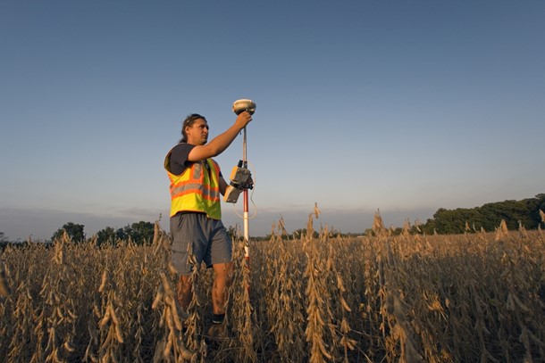
Apart from navigation, GPS is used for land surveying as well. GPS provides land surveyors with accurate latitude and longitude measurements. This system is particularly handy for large scale projects. Measuring massive acreage is time consuming. However, this task can be completed easily with GPS. As mentioned in our last blog, land surveying requires precise measurements. Instead of doing this by hand, GPS calculates data digitally which avoids mistakes.
Like every other system, there are several different ways to obtain data via GPS. Every method is just as useful to surveyors to mark relative locations. These GPS surveying methods include:
- Static GPS Baseline: Using two stationary GPS receivers, satellites connect to both receivers and compile their respective latitudes, longitudes, and height. This data is transferred to a GPS software that calculates information useful to land surveyors.
- Real Time Kinematic (RTK) Observations: Two GPS receivers are placed on either end of the property. One GPS receiver serves as the “base” and stays stationary, while the other receiver is transported about the survey boundaries. The position of the moving receiver is noted by the satellites and data is transferred to a GPS software
- Continuously Operating Reference Stations (CORS): A GPS receiver is permanently installed at a single location. This receiver can connect to any other receiver that is location within a certain area. Both the permanent and temporary receivers’ positions are tracked by satellites that transfer data to a GPS software.
CEDARVILLE Engineering Group, LLC (CEG) provides clients with accurate and precise surveying results with the enhancement of GPS. Call us at 610-705-4500 or email info@cedarvilleeng.com to find out more.
By: J. Auerbach
What can we do for you?
Address: CEDARVILLE Engineering Group, LLC 159 E. High Street, Suite 500 Pottstown, PA 19464 Phone: 610-705-4500 Fax: 610-705-4900 info@cedarvilleeng.com