Experts in Technology for Planning, Design, & Construction
CEDARVILLE Engineering Group, LLC (CEG) has invested in technology to provide a safer, streamlined, and all-encompassing approach to projects. Whether you are an Architectural, Civil Engineering, or Structural Engineering Firm, or a Construction or Utility company, we can provide aerial services that meet your needs. Our team of professionals include Professional Licenses Surveyors, Survey Technicians, and Certified Drone Pilots that bring over 20 years’ experience to your projects.
AERIAL MAPPING
Capturing data by Photogrammetry and/or LiDAR methods from our Unmanned Aerial Systems (sUAS) or partnered Manned Aircraft team we can create 3D Models to analyze and extract surface and/or planimetric features. These 3D models provide a valuable repository of the site conditions that can be accessible to the team/client. All our data is processed and stored in-house and from these 3D Models we can deliver 3D Terrain Models (TIN, DTM, XML, STM or Point Clouds), Ortho-Rectified Imagery, 2D and/or 3D base drawings (in AutoCAD or MicroStation Format), Elevation/Section Plans and more.
INSPECTION
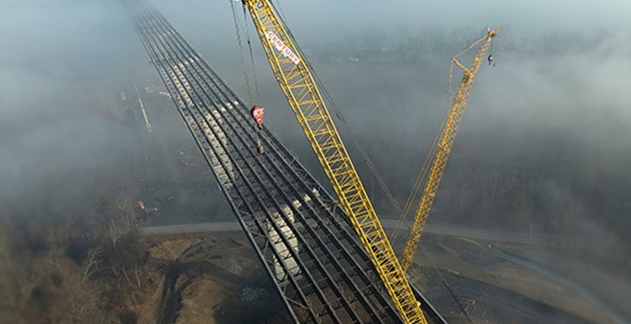
Safety is our priority. Utilizing our sUAS, we can document areas that pose safety risks. From documenting bridges, cell towers, and water Towers, to inspecting inside tanks or building exteriors and interiors, there is no match to the cost savings and risk prevention compared conventional methods.
SERVICES
- Topographic Surveys
- Volumetric/Quantity Surveys
- Inspection
- Bridges
- - Cell Towers
- - Water Towers
- - E & S Control Measures
- - Structural & Building
- - Gas & Oil Pipeline/Tank Farm
- Construction Progress Documentation
- - Pre-Construction
- - Progress/Key Benchmarks
- - Post-Construction
- Ortho Imagery Capture
- Near-infrared sensing
- Accident Scene/Forensic Documentation/Reconstruction
For more information, please call us at 610-705-4500 or email us at info@cedarvilleeng.com.