Geospatial Projects
3D Models, Photogrammetry, and Drone Videos
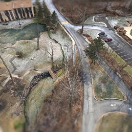
Painters Crossing
A Photogrammetric Survey was taken by an Unmanned Aerial System (UAS) to capture photographs to provide an existing conditions model for our client. The model illustrated manholes, building outlines, curbs, and roadways that helped identify current infrastructure conditions. Contours were also shown on the model for a better understanding of the terrain.

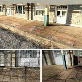
The Reading Railroad Pottstown Station
Ground based capture methods utilizing a camera was used to generate this 3D model. This model provided a snapshot in time. The data collected can be used as a baseline drawing to perform any necessary restoration work in the future.

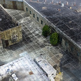
Eastern State Penitentiary
CEDARVILLE Engineering Group, LLC (CEG) was tasked with creating a 3D Reality Model to be used in the design a green stormwater infrastructure retrofit project for this 11+ acre historical penitentiary. Site design requires topographical features be surveyed with accuracy and precision. This site was more complex than usual due to the variety of surfaces constructed through history, and the un-mapped network of underground infrastructure beneath the site.

What can we do for you?
Address: CEDARVILLE Engineering Group, LLC 159 E. High Street, Suite 500 Pottstown, PA 19464 Phone: 610-705-4500 Fax: 610-705-4900 info@cedarvilleeng.com
