Drones Are Flying into the Surveying Industry
Drones Are Flying into the Surveying Industry
Look up at the sky. You usually see clouds, buildings, airplanes, and hot air balloons. Not too often however do you spot a small flying object a few hundred feet above the ground. This strange device is a drone, and it’s changing the dynamic of flying technology.
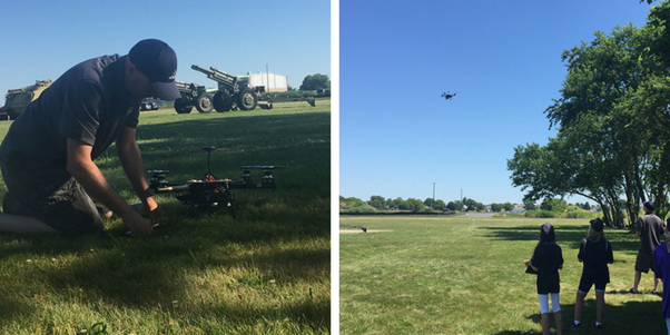
Drones go by many different names: UAV, sUAS, or RPAS, but what are they? Essentially, a drone is any unmanned aerial vehicle (UAV) that can navigate with a controller from the ground. Drones have several attachments and developments that can be utilized in prospective industries. The most compelling drone use is aerial photogrammetry in the surveying industry.
Surveying is a heavily profitable industry today. A drone’s versatility in the air provides a reliable source for surveying data. This way of surveying is fairly new, and the workflow will only get better over time. Drones can capture what we can’t necessarily see. Therefore, during a professional aerial survey, a certified drone specialist will hover across the surveying area to take several photos. Then, these multiple aerial photos are stitched together with a photogrammetry computer software. The end result is one large, detailed aerial photograph captured by an UAV.
So your surveyor gave you your aerial photograph, what’s next? This stitched photo provides a “bird’s eye” view of the area. Moreover, designated software provides 3D capabilities that are helpful to the client. This aerial survey provides information that may otherwise not be seen. Geospatial data is captured by the drone and recorded in the survey for future reference. This information is vital to a property in need of land development, construction, or expansion.
As discussed in previous blogs, there are different ways to acquire geospatial data through a survey. However, drones and aerial surveying have benefits that other types of land surveying lack, such as:
- Capturing large amounts of land in short periods of time.
- Reaching spaces that may be harmful to land surveyors.
- Creating masterpieces with one simple tool: a drone.
- Avoiding unconscious mistakes with the help of advanced technology.
- Processing sharp, high quality images in a computer software.
- Minimizing cost with respect to a single drone installation.
CEDARVILLE Engineering Group, LLC (CEG) is equipped with expert land surveyors that are certified to capture aerial photogrammetry assets. Call us at 610-705-4500 or email info@cedarvilleeng.com for a demonstration of our UAV reality capture process.
By: J. Auerbach
What can we do for you?
Address: CEDARVILLE Engineering Group, LLC 159 E. High Street, Suite 500 Pottstown, PA 19464 Phone: 610-705-4500 Fax: 610-705-4900 info@cedarvilleeng.com